
There's a new map that shows where you can and can't fly your drone
Australian drone operators and the community now have access to a digital map that shows local restrictions that may be in place for flying drones in their area.
The first release of the Department of Infrastructure, Transport, Regional Development, Communications and the Art’s (the department) new drone map shows rules for 7,610 different areas managed by 15 different agencies, with more to be digitised in the future.
For example, the map shows drone laws around parks and correctional facilities across Australia that have restrictions.
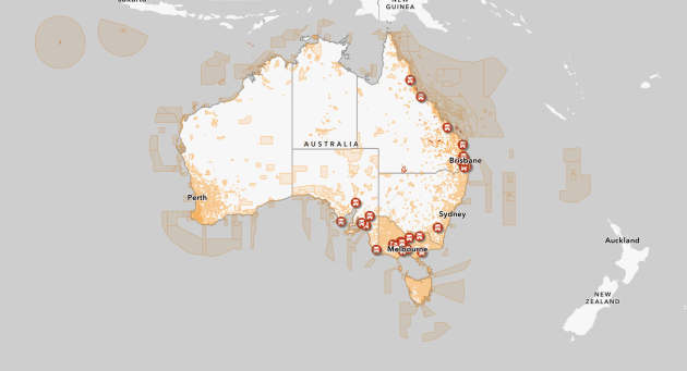
The department hopes the free digital and geospatial map of local laws will help increase awareness of and compliance with drone laws.
The map can be integrated into drone software applications to help with flight planning, thanks to open data and a free application programming interface.
The move comes as The Civil Aviation Safety Authority (CASA) has increasingly tightened Australia's drone flying rules. In 2021, CASA introduced a $40 registration fee for drones weighing over 500g that are used for commercial purposes.
The department is welcoming feedback to help improve the functionality of its new map. To view it and provide your feedback, visit www.drones.gov.au/policies-and-programs/initiatives/drone-rule-digitisation.